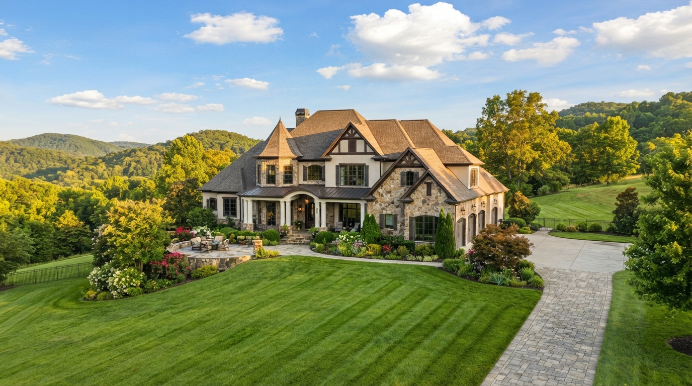
Begin With the Setting
Luxury Areas & Communities in Knoxville & East Tennessee
The right property begins with the way you want daily life to feel.
Luxury takes different forms across Knoxville and East Tennessee. One household may value an established city setting close to familiar routines. Another may prioritize water access, open land, a planned community, downtown convenience or a foothill connection.
This guide helps you compare those settings through practical questions: the kinds of properties you may encounter, the daily-life advantages that may matter, the tradeoffs worth considering and the address-specific details that require verification.
Return to the Luxury Living GuideCompare Context Before Addresses
What Changes From One Setting to Another?
A home does not exist separately from its surroundings. Road access, lot patterns, utilities, association structure, water or land relationships, nearby services and the pace of development can shape ownership as much as architecture or interior finishes.
The purpose of this guide is not to identify a single “best” area. It is to help your household recognize which setting supports its priorities—and which questions should be answered for a particular property before assumptions become decisions.
As you compare areas, consider three layers:
- Daily life: Where will the household regularly go, and how does the setting support those routines?
- Property context: What land, water, building, infrastructure or association characteristics commonly deserve closer review?
- Address-specific verification: Which facts must be confirmed for the individual property rather than inferred from a community name or map?
Community descriptions provide general orientation only. Boundaries, travel times, schools, services, restrictions, utilities, taxes, insurance, amenities and property characteristics must be verified for the specific address.
A More Useful Comparison
Compare the Setting, Not a Reputation
A familiar community name can be a helpful starting point, but it cannot explain how a specific address will work for your household. Compare locations through the parts of ownership and daily life that can be observed, researched and verified.
Daily Routes & Practical Access
Begin with the places the household expects to use regularly rather than a single commute estimate. Consider work, healthcare, airport access, groceries, recreation, family connections and the routes that matter at different times of day.
Compare: route options, timing at relevant hours, road character, seasonal conditions and whether frequent trips remain comfortable in practice.
Property Pattern & Sense of Space
Settings differ in lot size, topography, setbacks, housing age, density and the relationship between neighboring properties. Decide what kind of privacy, outdoor use and maintenance responsibility feels appropriate.
Compare: lot pattern, terrain, mature landscaping, visibility, building scale, outdoor areas and the amount of land or exterior upkeep the household wants to manage.
Utilities, Roads & Infrastructure
Two nearby properties may rely on different roads, water sources, wastewater systems, internet service or drainage arrangements. Infrastructure is address-specific and can influence maintenance, insurance and future plans.
Compare: public or private roads, water and wastewater service, power, internet, drainage, emergency access and responsibility for shared infrastructure.
Governance, Use & Shared Obligations
An established neighborhood, planned community, condominium building and rural property can involve very different rules and decision-makers. Understand what governs the property before relying on an intended renovation, rental, accessory structure or recreational use.
Compare: zoning, recorded restrictions, association documents, architectural review, shared amenities, fees and approval requirements for future plans.
Property Type & Due-Diligence Needs
Location and property type often overlap. Waterfront, acreage, historic construction, custom systems, condominiums and golf-oriented communities may require different records and specialists even when they share a postal address.
Compare: defining property features, documentation available, specialist review, insurance questions, operating requirements and long-term serviceability.
Change Over Time
A useful comparison includes what is present today and what may reasonably change. Review adopted plans and current public records where relevant, while recognizing that proposed development, travel patterns, services and views cannot be guaranteed.
Compare: current surroundings, approved or active projects, road plans, remaining development, nearby land use and which valued characteristics are controlled by the property owner.
Identify the Three Conditions That Matter Most
Before comparing named areas, ask the household to choose:
- Three conditions that should be present for daily life to work well.
- Three tradeoffs that may be acceptable for the right property.
- Three facts that must be independently verified before a location can remain on the shortlist.
Keep these lists separate. A preference, an acceptable compromise and a required fact should not carry the same weight in the decision.
Example categories only: routine destinations, setting, privacy, water or land relationship, maintenance, association structure, airport access, healthcare access, property type and future-use plans.
Do not prefill personal answers or recommend a location based on protected characteristics.
Regional Orientation
Areas & Settings in This Guide
The sections ahead provide general orientation to several East Tennessee settings that buyers often compare. They are not rankings, fixed boundaries or a complete inventory of places where distinctive homes may be found.
- Established Knoxville Neighborhoods
- West Knoxville, Northshore & Farragut
- Hardin Valley & Northwest Growth Areas
- Loudon County & the Southwest Lake Corridor
- Maryville, Alcoa & Blount County
- Downtown Knoxville
- Oak Ridge, Melton Hill & Regional Acreage
Community descriptions are general orientation only. Boundaries, routes, travel times, schools, services, restrictions, utilities, taxes, insurance, amenities, development activity and property characteristics must be independently verified for the specific address.
Established City Setting
Established Knoxville Neighborhoods
Knoxville’s established neighborhoods can offer mature streetscapes, individual architecture and a closer relationship with longstanding city destinations. The experience varies from one street and property to the next, so the useful comparison is not old versus new. It is whether the home’s location, condition and ownership responsibilities fit the household.
Sequoyah Hills may be one familiar point of reference, but it should not stand in for every established Knoxville setting. Neighborhood names, boundaries, housing patterns, overlays and access can differ—and listing language may use an area name more broadly than official records do.
What You May Encounter
Properties may include renovated homes, houses retaining substantial original material, later infill, architect-designed residences and homes expanded over several decades. Lot size, topography, setbacks and the relationship between homes can change within a relatively short distance.
Compare: construction era, renovation history, architectural character, lot pattern, grade, outdoor use, neighboring scale and whether the home’s systems match its visible finishes.
Why the Setting May Appeal
Buyers may value established landscaping, street character and access to the city destinations that matter to their routines. The practical benefit depends on the individual address and the routes the household will actually use.
Compare: access to work, healthcare, shopping, parks, cultural destinations and frequently used roads at relevant days and times—without relying on one advertised travel estimate.
Renovation, Additions & Building History
An updated interior does not explain what was changed behind the finishes. For older or extensively renovated homes, ask how additions, structural work, electrical service, plumbing, roofing, drainage and heating or cooling systems evolved.
Compare: available plans, permits, alteration chronology, system ages, water-management history, contractor records and whether specialized inspection or engineering review is appropriate.
Lots, Trees, Drainage & Outdoor Responsibility
Mature landscaping can be an important part of the setting and may also require thoughtful maintenance. Observe how water moves across the site, how slopes relate to foundations and driveways, and how trees interact with roofs, utilities and neighboring property.
Compare: grading, drainage paths, retaining walls, tree condition, utility locations, irrigation, driveway access, exterior maintenance and responsibility for work near property lines.
Streets, Parking & Everyday Access
Street width, sidewalks, driveways, alleys and on-street parking vary. Test arrival and departure rather than evaluating access only from listing photographs or a quiet showing appointment.
Compare: driveway grade, garage dimensions, turning space, guest parking, delivery access, pedestrian route, visibility, traffic conditions and service access.
Rules, Overlays & Future Plans
Age or architectural character does not automatically establish historic designation or restriction. Confirm zoning, recorded restrictions, any applicable design-review process and the approvals required for the household’s future plans.
Compare: parcel zoning, local overlays, easements, recorded restrictions, renovation approvals, accessory-structure rules, tree or site requirements and permits for intended work.
The Meaningful Tradeoff
The character that makes an established setting appealing may come with more property-specific variation than a newer planned community. Buyers should be comfortable evaluating the home’s building history, site conditions and maintenance needs individually rather than assuming consistency from the neighborhood name.
Verify before deciding: the official address and parcel, boundaries used by relevant agencies, intended renovations or uses, property condition, insurance considerations and every route or service important to the household.
Experience the Address as Part of a Routine
On a second visit:
- Approach the property using the household’s likely daily route.
- Test driveway, garage and guest-parking access.
- Walk the site and observe grade, drainage, trees and neighboring relationships.
- Note exterior elements that may require specialized maintenance.
- Revisit during a different time or day when practical.
- List every future property change that depends on approval or verification.
Record observations without drawing conclusions about structural condition, safety, neighborhood demographics or future market performance.
Is an established Knoxville setting part of your search?
Denise can help you compare the household’s priorities with the address-specific property, route and due-diligence questions that deserve attention.
This section provides general orientation, not a boundary, ranking or statement about every property in an area. Verify the specific address, zoning, overlays, restrictions, utilities, condition, routes, services, taxes, insurance and intended uses through the appropriate records, authorities and qualified professionals.
West & Southwest Knoxville Context
West Knoxville, Northshore & Farragut
West Knoxville, the Northshore corridor and Farragut frequently appear in the same broad home search, but they should not be treated as one interchangeable location. Municipal boundaries, road patterns, utilities, associations, lot character and proximity to water can change across individual addresses.
The useful comparison begins with the household’s routines and desired property setting, then narrows to the jurisdiction, parcel and ownership details of each home.
What You May Encounter
The search may include established subdivisions, renovated residences, newer enclaves, custom homes, planned communities and properties influenced by the area’s lake and inlet geography. Housing age, density, lot size and shared amenities vary substantially.
Compare: construction era, renovation history, lot pattern, association structure, shared amenities, water relationship, terrain and the maintenance expectations attached to each property.
Daily Services & Regional Access
Many households consider this part of the region because it can connect residential settings with employment, shopping, healthcare and major travel routes. Convenience must still be tested from the specific address at the times the household expects to travel.
Compare: route choices, intersection patterns, school-day or peak-hour conditions, airport route, healthcare access, recurring destinations and alternatives when a primary corridor is congested.
Northshore Is a Corridor, Not One Property Experience
“Northshore” may describe a broad search relationship rather than one official neighborhood. A Northshore-area property may feel suburban, wooded, waterfront-oriented or more rural depending on its precise location.
Compare: exact jurisdiction, road access, public or private infrastructure, shoreline or water-view relationship, topography, utilities, association obligations and distance from the household’s regular destinations.
Farragut & Municipal Verification
Do not infer Town of Farragut jurisdiction from a postal address, listing label or general search area. Confirm the parcel’s governing jurisdiction and the agencies responsible for zoning, permits, roads, services and future-project review.
Compare: municipal boundary, parcel zoning, recorded restrictions, development standards, permit authority, utilities, association documents and approvals required for planned changes.
Planned Communities, Associations & Amenities
Community amenities may be association-owned, club-operated, separately priced or subject to eligibility and use rules. A gated entrance, pool, marina or golf relationship should be evaluated through current documents rather than marketing shorthand.
Compare: governing documents, fees, reserves, assessments, architectural review, amenity ownership, membership terms, guest access and responsibility for roads or shared infrastructure.
Water, Terrain & Site Conditions
Proximity to Fort Loudoun Lake or an inlet does not establish waterfront ownership, dock rights, year-round water, protected views or flood status. Slopes, drainage and shoreline conditions are property-specific.
Compare: deed and survey, shoreline relationship, dock documentation, flood information, elevation, drainage, retaining features, access to outdoor areas and specialized insurance questions.
Growth, Traffic & Future Context
Current surroundings may change as roads, services and nearby parcels evolve. Review current public information when change matters to the decision, but do not treat a proposal as a guaranteed outcome.
Compare: adopted plans, active public projects, approved nearby development, remaining buildout, construction access and which valued property characteristics are within the owner’s control.
The Meaningful Tradeoff
This broad search area may offer many combinations of services, community structure, water relationship and housing pattern. That variety makes address-level comparison essential; a familiar location label cannot substitute for testing routes, documents and site conditions.
Verify before deciding: jurisdiction, school assignment when relevant, utilities, association and club obligations, water rights, intended uses, travel routes, taxes, insurance and property condition.
Compare Two Properties Using the Same Route and Records
For each shortlisted address:
- Confirm city or county jurisdiction and the responsible permitting authority.
- Drive the same two or three household routes at comparable times.
- Identify public, private and association-maintained infrastructure.
- Separate verified water or amenity rights from proximity and views.
- Review association and separate club obligations independently.
- Note nearby approved or active projects that materially affect the decision.
Use the same questions for both properties so a stronger first impression does not receive lighter scrutiny.
Comparing addresses across West Knoxville and Farragut?
Denise can help you organize the household’s route, setting and property-specific questions so each address receives the same careful comparison.
This section provides general orientation, not fixed boundaries or a statement about every property. Verify jurisdiction, routes, schools, services, utilities, restrictions, amenities, water relationships, taxes, insurance, development activity and property characteristics for the specific address.
Newer Construction & Evolving Context
Hardin Valley & Northwest Growth Areas
Hardin Valley and portions of northwest Knox County can bring newer communities, custom construction, remaining acreage and active development into the same search. That mix creates choices in home age, lot pattern and community structure—along with practical questions about roads, utilities and how the surrounding setting may evolve.
The area name is a useful orientation point, not a uniform boundary or promise about an individual address. Compare the parcel, jurisdiction, infrastructure and current public records for each property.
What You May Encounter
Properties may include recently completed homes, established subdivisions, new phases under construction, custom residences and parcels with a more open or rural relationship. Similar-looking homes may have different builders, documents, associations and utility arrangements.
Compare: completion date, builder and warranty information, lot ownership, construction records, association structure, remaining buildout and whether nearby construction is active.
New Construction & Builder Documentation
Newer does not eliminate the need for careful review. Ask what was built, changed or selected for the specific home and how warranty, service and final-item responsibilities transfer to the buyer.
Compare: plans and specifications, permits, certificate of occupancy, change orders, selections, inspections, warranties, builder contacts, final walkthrough records and unresolved items.
Roads, Intersections & Daily Routes
Growth can place older road patterns and new residential demand in the same corridor. Test the routes the household will use at relevant times and understand whether access depends on one primary road or offers practical alternatives.
Compare: driveway and subdivision access, intersection movements, peak-hour conditions, school-day traffic, alternate routes, road ownership, planned road work and emergency access.
Utilities & Property Infrastructure
Service availability can differ by address, especially where suburban development meets larger parcels. Confirm the provider and capacity for each essential service rather than assuming a nearby property has the same arrangement.
Compare: water source, sewer or septic, electric provider, natural gas availability, internet service, stormwater features, private infrastructure and responsibility for future maintenance.
Lots, Drainage & Construction Activity
A finished home may sit within an unfinished phase. Observe grading, drainage, construction traffic, temporary access and how adjacent lots may affect the property while the surrounding section is completed.
Compare: recorded plat, easements, common drainage, retaining features, erosion controls, unfinished lots, construction access, builder control and the approved plan for nearby parcels.
Associations, Amenities & Development Phases
Rules and fees may change as a community moves from developer control to owner governance. Confirm which amenities are complete, who owns them and whether additional phases or facilities are approved, proposed or merely marketed.
Compare: declaration and amendments, current budget, transfer timing, amenity ownership, completion status, future phases, architectural review, assessments and responsibility for private roads or facilities.
Jurisdiction, Schools & Address Verification
Mailing labels and informal area names do not establish jurisdiction or school assignment. Verify the parcel with the responsible agencies when taxes, permits, services, schools or future use matter to the decision.
Compare: parcel record, governing jurisdiction, zoning, permit authority, official school-assignment source, emergency services, utilities and recorded restrictions.
The Meaningful Tradeoff
An evolving setting may offer newer construction and additional choices while requiring buyers to evaluate incomplete surroundings and future change. The key is separating what exists and is documented now from what is proposed, expected or shown in marketing materials.
Verify before deciding: final home documents, warranties, jurisdiction, utilities, association obligations, current and approved development, recurring routes, drainage, insurance and every future feature material to the purchase.
Separate Existing, Approved & Proposed
For each important surrounding feature, place it in one category:
- Existing: Complete, observable and available for its stated use today.
- Approved or under construction: Supported by current official records, with status and timing independently checked.
- Proposed or marketed: Discussed or illustrated but not relied upon as a purchase fact.
Apply this exercise to roads, adjacent development, amenities, landscaping, commercial services and community buildout. Keep the supporting source and verification date with each item.
Comparing a completed home with a community still taking shape?
Denise can help you organize the builder, infrastructure, route and development questions that deserve answers for each address.
This section provides general orientation, not fixed boundaries or a prediction of growth. Verify jurisdiction, roads, schools, services, utilities, restrictions, association obligations, development approvals, taxes, insurance and property characteristics for the specific address through current official records and qualified professionals.
Lake, Community & Regional Access
Loudon County & the Southwest Lake Corridor
Loudon County and the southwest lake corridor can bring Tellico and Fort Loudoun relationships, planned communities, golf-oriented settings, independent waterfront homes and properties with more land into the same broad search.
Those experiences are not interchangeable. Begin by identifying the household’s preferred relationship with water and community, then verify the legal, physical and operational details of each address.
What You May Encounter
The search may include direct waterfront, community lake access, water views, planned neighborhoods, golf-oriented communities, custom homes and properties beyond a large association structure. Location labels alone do not explain access rights, maintenance or daily routines.
Compare: property type, shoreline relationship, community structure, lot pattern, terrain, housing age, amenities and the ownership responsibilities attached to each feature.
Define the Water Relationship
Direct waterfront, a community dock, a boat-slip arrangement, nearby launch access and a water view describe different rights and experiences. Confirm what transfers with the property and which permissions, agreements or ongoing fees apply.
Compare: deed and survey, shoreline boundary, dock or slip documentation, access agreements, community facilities, water-depth context, flood information, insurance questions and maintenance responsibility.
Planned Community or Independent Property
A planned community may coordinate amenities, roads, architectural standards and shared services. An independent property may offer fewer shared rules while placing more infrastructure and site responsibility with the owner.
Compare: association documents, fees, reserves, assessments, architectural review, private roads, shared infrastructure, amenities, owner-maintained systems and future-project approvals.
Golf & Separate Membership Obligations
A home’s location within a golf-oriented community does not establish that club membership is included, required, available or transferable. Review association ownership and private-club membership as separate relationships.
Compare: membership requirement, category, availability, initiation terms, recurring charges, assessments, transfer rules, privileges, resignation terms and which facilities are association-owned.
Daily Services & Knoxville Connection
The practical fit depends on more than mileage. Test the routes to work, healthcare, groceries, airport access, recreation and family connections at the days and times likely to matter.
Compare: primary and alternate routes, travel at relevant hours, service access, emergency response information, recurring destinations and whether seasonal or event conditions alter the routine.
Utilities, Wastewater & Private Infrastructure
Water, sewer, septic, internet, roads and drainage arrangements can vary across this broad area. Confirm providers and responsibilities for the individual parcel, including capacity for intended additions or uses.
Compare: public or private water, sewer or septic records, electric provider, internet service, road ownership, shared drives, drainage, backup power and maintenance agreements.
Shoreline, Terrain & Long-Term Maintenance
Slopes, retaining systems, shoreline stabilization, docks, seawalls, drainage and mature landscaping may require specialized review and continuing care. A calm showing-day view does not establish year-round conditions or future approval.
Compare: elevation, slope, erosion history, drainage, retaining structures, shoreline work, dock condition, permits, service access and long-term maintenance planning.
The Meaningful Tradeoff
The lake relationship and community amenities may shape daily life as much as the home itself. Buyers benefit from deciding which features they will use regularly and which obligations remain worthwhile even if fees, access procedures or maintenance needs change.
Verify before deciding: legal water and amenity rights, association and club obligations, jurisdiction, utilities, wastewater capacity, routes, flood and insurance information, property condition and future-use approvals.
Name the Experience Before Comparing Homes
Choose the relationship the household actually wants:
- Direct waterfront with property-specific shoreline responsibilities.
- Assigned or deeded boat-slip arrangement.
- Shared community dock or launch access.
- Convenient access to a public launch or marina.
- Water view without access rights.
- Lake-oriented community life without a water-dependent property.
Then verify whether each shortlisted address provides that exact relationship, how it is documented and what it costs to operate or maintain.
Comparing lake relationships and community structures?
Denise can help you organize the water, association, route and property-specific questions that should be answered before one address rises to the top.
This section provides general orientation, not a guarantee of water access, dock approval, year-round conditions, amenities or fixed boundaries. Verify the deed, survey, shoreline and dock records, association and club documents, jurisdiction, utilities, wastewater, routes, flood information, insurance and property condition for the specific address.
In-Town, Foothill & Regional Connections
Maryville, Alcoa & Blount County
Maryville, Alcoa and surrounding portions of Blount County offer several different relationships to East Tennessee living. A search may include established in-town homes, newer residential communities, foothill settings, custom residences and properties with land.
These locations share a county context but are not interchangeable. City or county jurisdiction, routes, services, utilities, topography and proximity to the airport, Knoxville or mountain gateways must be evaluated from the specific address.
What You May Encounter
The property mix can range from older homes near established destinations to newer communities and larger parcels beyond denser in-town settings. Housing age, lot pattern, building history and infrastructure can shift across short distances.
Compare: construction era, renovation or builder documentation, lot size, topography, neighboring land use, association structure, utilities and the maintenance implied by the setting.
In-Town or Broader County Setting
An in-town address may create a different relationship with services, streets and utilities than a property farther into the county. Decide whether the household values closer daily connections or additional land and separation enough to accept different ownership responsibilities.
Compare: jurisdiction, recurring routes, service providers, water and wastewater, road maintenance, property access, outdoor upkeep and proximity to the household’s actual destinations.
Airport & Knoxville Relationships
Regional connections may be an important reason to consider this area, but travel should be tested rather than summarized by mileage or a best-case estimate. The relevant route depends on the address, time and destination.
Compare: airport route, Knoxville route, healthcare access, work destinations, alternate roads, peak-hour conditions and the frequency with which each trip will occur.
Foothill Setting, Views & Terrain
A foothill relationship may involve views, elevation changes, wooded surroundings or easier access toward mountain recreation. None of these characteristics should be inferred from a broad Blount County label.
Compare: actual view, ownership of intervening land, slope, driveway grade, drainage, retaining features, tree maintenance, emergency access and whether a valued view is protected by any enforceable right.
Acreage, Outbuildings & Intended Use
Land can support privacy, recreation, animals, gardening or additional structures only when the parcel’s usable condition and governing rules support those plans. Acreage totals do not show terrain, access, soils or permitted use.
Compare: survey, boundaries, easements, zoning, restrictions, soils, septic capacity, water, fencing, outbuilding records, access and approvals required for the intended use.
Utilities, Wastewater & Property Systems
Utility arrangements may change between municipalities, communities and larger parcels. Confirm providers, system locations and capacity for the individual property, especially where a household anticipates expansion or a flexible living arrangement.
Compare: public or private water, sewer or septic records, electric provider, gas availability, internet service, drainage, wells, backup systems and responsibility for shared infrastructure.
Mountain Access Without a Tourism Assumption
Proximity to Great Smoky Mountains gateways may matter to a household’s recreation or travel plans, but the residential experience should not be reduced to a tourism image. Test the actual route and distinguish everyday access from seasonal or event conditions.
Compare: route used, traffic at relevant times, weather and seasonal conditions, distance from regular services, outdoor-property maintenance and how often the household expects to make the trip.
The Meaningful Tradeoff
This broad area can offer a choice among in-town connection, newer community structure, foothill context and additional land. The tradeoff is that the household must compare different jurisdictions, infrastructure arrangements and routes rather than assume one Blount County experience.
Verify before deciding: parcel jurisdiction, schools when relevant, utilities, wastewater, routes, restrictions, land usability, view and access assumptions, taxes, insurance, property condition and intended-use approvals.
Compare One Week of Real Life
For each shortlisted address:
- List the household’s five most frequent destinations.
- Test the most important routes at relevant times.
- Identify the jurisdiction and providers responsible for the address.
- Record which exterior, land and infrastructure responsibilities belong to the owner.
- Separate occasional recreational access from everyday service access.
- Note every intended property use requiring official confirmation.
The goal is not to minimize every drive or maintenance task. It is to understand whether the setting supports the household’s actual priorities.
Comparing in-town, foothill and acreage settings in Blount County?
Denise can help you organize the routes, property responsibilities and address-specific questions that should guide the comparison.
This section provides general orientation, not fixed boundaries or a statement about every property. Verify jurisdiction, routes, schools, services, utilities, wastewater, restrictions, land usability, taxes, insurance, views, development activity and property characteristics for the specific address.
Urban Residence & Building Context
Downtown Knoxville
Downtown Knoxville can offer a closer relationship with dining, arts, events, employment and public spaces, along with a residential experience shaped by the building and surrounding streets. Condominiums, loft-style residences and other urban homes should be evaluated as more than interior living space.
The useful comparison includes the unit, the building, the association, parking and storage rights, the route at street level and the way activity changes throughout the week.
What You May Encounter
Residences may be located in adapted older buildings, purpose-built condominiums, mixed-use properties or smaller developments with different service and amenity levels. Floor plan, outdoor space, parking and association responsibility can vary materially.
Compare: ownership form, building history, unit boundaries, renovation records, windows and views, outdoor areas, parking, storage, amenities and responsibility for shared components.
Building & Association Health
A strong interior presentation does not explain the condition or financial planning of the full building. Review current governing and financial documents along with records for major shared systems and planned work.
Compare: declaration and rules, budget, reserves, assessments, meeting minutes, master insurance, roof and façade history, elevators, plumbing, fire-safety systems and pending capital projects.
Parking, Storage & Arrival
Parking may be deeded, assigned, leased, separately owned or located outside the building. Storage and loading arrangements can be equally important to daily convenience.
Compare: legal parking right, space dimensions, garage clearance, access control, guest parking, electric-vehicle charging, storage assignment, loading route, move procedures and package handling.
Walk Routes & Everyday Destinations
Do not reduce the location to a generalized walkability claim. Walk the actual routes the household expects to use and observe crossings, grade, lighting, weather exposure and activity at relevant times.
Compare: route to recurring destinations, sidewalk and crossing conditions, terrain, building entrances, late-hour access, event closures and whether the route remains comfortable for the household’s needs.
Sound, Events & Time-of-Day Change
Street activity, venues, deliveries, refuse collection and events may create different conditions by hour and day. Visit more than once when these factors matter to the decision.
Compare: weekday morning, evening, weekend and event conditions; unit orientation; window performance; nearby loading; mechanical noise; and building rules affecting residents and guests.
Renovation & Use Rules
Interior work may require association approval, permits, contractor insurance, elevator scheduling or restrictions on flooring, plumbing and structural changes. Leasing, pets and guest use may also be regulated.
Compare: architectural review, permitted scope, contractor requirements, work hours, deposits, utility shutoffs, rental rules, pet rules, guest policies and move scheduling.
Nearby Development & View Assumptions
An urban view and surrounding activity can change. Review current public records for nearby approved or active projects when light, access, construction or a particular outlook is material to the purchase.
Compare: ownership of nearby parcels, adopted plans, active construction, approved projects, street changes, temporary closures and whether any valued view or open space is protected.
The Meaningful Tradeoff
Downtown living can place frequently used destinations closer while making shared-building governance, parking and changing street conditions more important. The decision should reflect the household’s real routines rather than a weekend visit alone.
Verify before deciding: unit and parking rights, association documents, building condition, insurance, renovation and leasing rules, recurring routes, time-of-day conditions, nearby development and all ownership costs.
Test the Residence From Door to Destination
During a second visit:
- Travel from the parking space or street entrance to the unit.
- Follow the route to mail, packages, storage and refuse areas.
- Walk to two destinations the household expects to use regularly.
- Test guest arrival, parking and building entry.
- Observe sound and activity from inside the unit at a different time.
- Confirm how a move, delivery or contractor visit would work.
Record the repeated points of convenience and friction. Small steps experienced daily may matter more than amenities used occasionally.
Comparing downtown residences or buildings?
Denise can help you organize the unit, association, parking, route and lifestyle questions that deserve a closer look.
This section provides general orientation, not a guarantee about walkability, noise, safety, parking, views or future development. Verify the unit, building, association, title, insurance, routes, rules, costs and surrounding conditions for the specific address through current records and qualified professionals.
Established City, Water & Broader Land Choices
Oak Ridge, Melton Hill & Regional Acreage
Oak Ridge and the surrounding Melton Hill corridor can combine an established employment center with wooded residential settings, water and recreation connections, varied architecture and properties extending into less densely developed areas.
Depending on the address, a buyer may encounter a mid-century home, substantial renovation, newer construction, a lake-oriented property or acreage. These possibilities belong in one broad search only when their different routes, infrastructure and ownership responsibilities are compared directly.
What You May Encounter
Housing type, age and site relationship can vary considerably. A wooded city property, waterfront-oriented residence and larger regional parcel may require different records, maintenance plans and professional review.
Compare: construction era, renovation history, lot and terrain, water relationship, road access, utilities, outbuildings, association structure and the property’s ongoing maintenance demands.
Oak Ridge Daily-Life Context
Access to Oak Ridge employment, services and recreation may influence the search, but convenience depends on the individual address and the household’s recurring destinations. Test the real route rather than relying on a generalized regional description.
Compare: work route, healthcare, groceries, Knoxville connection, alternate roads, travel at relevant hours, service-provider access and the frequency of each trip.
Mid-Century, Renovated & Distinctive Homes
Architectural character and renovation quality should be evaluated separately. For an older or extensively modified home, determine what remains original, what changed and how structural, electrical, plumbing, roofing, drainage and mechanical work was documented.
Compare: plans, permits, alteration history, system ages, water-management records, materials, warranties and whether specialized inspection or engineering review is appropriate.
Melton Hill & Water Relationships
Melton Hill proximity does not establish waterfront ownership, access, dock rights, water depth, flood status or a protected view. Identify the exact relationship and the documents, agencies or agreements that govern it.
Compare: deed and survey, shoreline boundary, access agreements, dock records, water conditions, flood information, slope, drainage, insurance questions and long-term shoreline or structure maintenance.
Regional Acreage & Land Use
Larger parcels may offer privacy, recreation, animals, gardening or additional structures only when the land and applicable rules support the intended plan. Acreage totals do not show usable area, access, soils or infrastructure.
Compare: survey, boundaries, easements, topography, soils, water, septic capacity, fencing, outbuildings, zoning, restrictions and approvals required for the intended use.
Roads, Utilities & Jurisdiction
As a search extends beyond denser city settings, road ownership, utilities, internet and wastewater arrangements may change. Confirm the responsible jurisdiction and provider for every shortlisted address.
Compare: municipal or county jurisdiction, public or private road, shared access, water source, sewer or septic, electric provider, internet, drainage, emergency access and infrastructure-maintenance agreements.
Recreation Access Without a Property Assumption
Nearby water, greenways, parks or other recreation may matter to a household’s routine, but proximity does not grant private access or guarantee operating conditions. Confirm the route, hours, rules and availability from current responsible sources.
Compare: public access point, route, parking, seasonal or operating conditions, household frequency of use and whether the property itself carries any documented recreational right.
The Meaningful Tradeoff
This broad search can offer established city access, architectural variety, water relationships and additional land. The tradeoff is greater variation in property age, site demands, infrastructure and travel patterns—making consistent address-level verification especially important.
Verify before deciding: jurisdiction, routes, utilities, wastewater, land usability, water and access rights, renovation records, restrictions, insurance, property condition and approvals for intended use.
Compare Different Settings Without Changing the Standard
If the shortlist includes a city home, lake-oriented property and acreage residence, record the same categories for each:
- Daily routes and recurring service access.
- Property condition and documentation.
- Public, private and shared infrastructure.
- Water, land or recreational rights actually conveyed.
- Annual and long-term maintenance responsibilities.
- Intended uses requiring approval or further evaluation.
The properties may offer very different experiences, but each should receive the same level of documentation and investigation.
Comparing city access, water relationships and regional acreage?
Denise can help you organize the routes, records, infrastructure and property-specific questions needed to compare very different settings on equal terms.
This section provides general orientation, not fixed boundaries or a guarantee of acreage, water access, recreation, travel time or utility service. Verify jurisdiction, routes, schools, services, roads, utilities, wastewater, restrictions, water and land rights, taxes, insurance and property characteristics for the specific address.
From Regional Search to Address-Level Decision
Choose the Setting Before the Search Becomes a List of Homes
A useful location decision is not a contest between community names. It is a comparison between the household’s priorities and the real conditions attached to each address.
The right setting should support everyday routines, the preferred property type and the responsibilities the household is willing to carry—while leaving important claims to current records and qualified sources.
Before an Area Reaches the Shortlist
Ask:
- Does the setting support our repeated routines? Test the routes and destinations that will shape ordinary weeks, not only occasional visits.
- Can we find the property type we actually want there? Compare the home, land, water, building or community relationship rather than relying on a broad area label.
- Do the infrastructure and ownership obligations fit us? Consider roads, utilities, wastewater, associations, clubs, shared systems and exterior maintenance.
- Which valued conditions belong to the property—and which may change? Separate deeded rights and owner-controlled features from views, nearby land, proposed projects and community amenities.
- Have we verified the facts that could change the decision? Confirm jurisdiction, schools when relevant, restrictions, services, taxes, insurance and intended uses for the specific address.
Build a Shortlist That Can Survive Better Information
Keep three records for each serious location:
- What the household values about the setting.
- What the household is willing to trade for the right property.
- What must be independently verified before making a commitment.
A strong shortlist should become clearer as better information arrives. If the appeal depends on an unverified assumption, treat that assumption as a question—not a feature.
Ready to Compare Settings Through Your Own Priorities?
Denise can help you translate the household’s routines, property preferences and ownership expectations into a focused East Tennessee search.
A starting point, not an address-level conclusion
These regional descriptions provide general orientation. Community boundaries, routes, travel times, schools, taxes, utilities, zoning, restrictions, road conditions, insurance, amenities, development activity and property characteristics should be independently verified for the specific address. A setting can change substantially from one road, shoreline segment, building or parcel to the next.